Proprietary Technology
PEMS Pulsating Electro-Magnetic Sounding
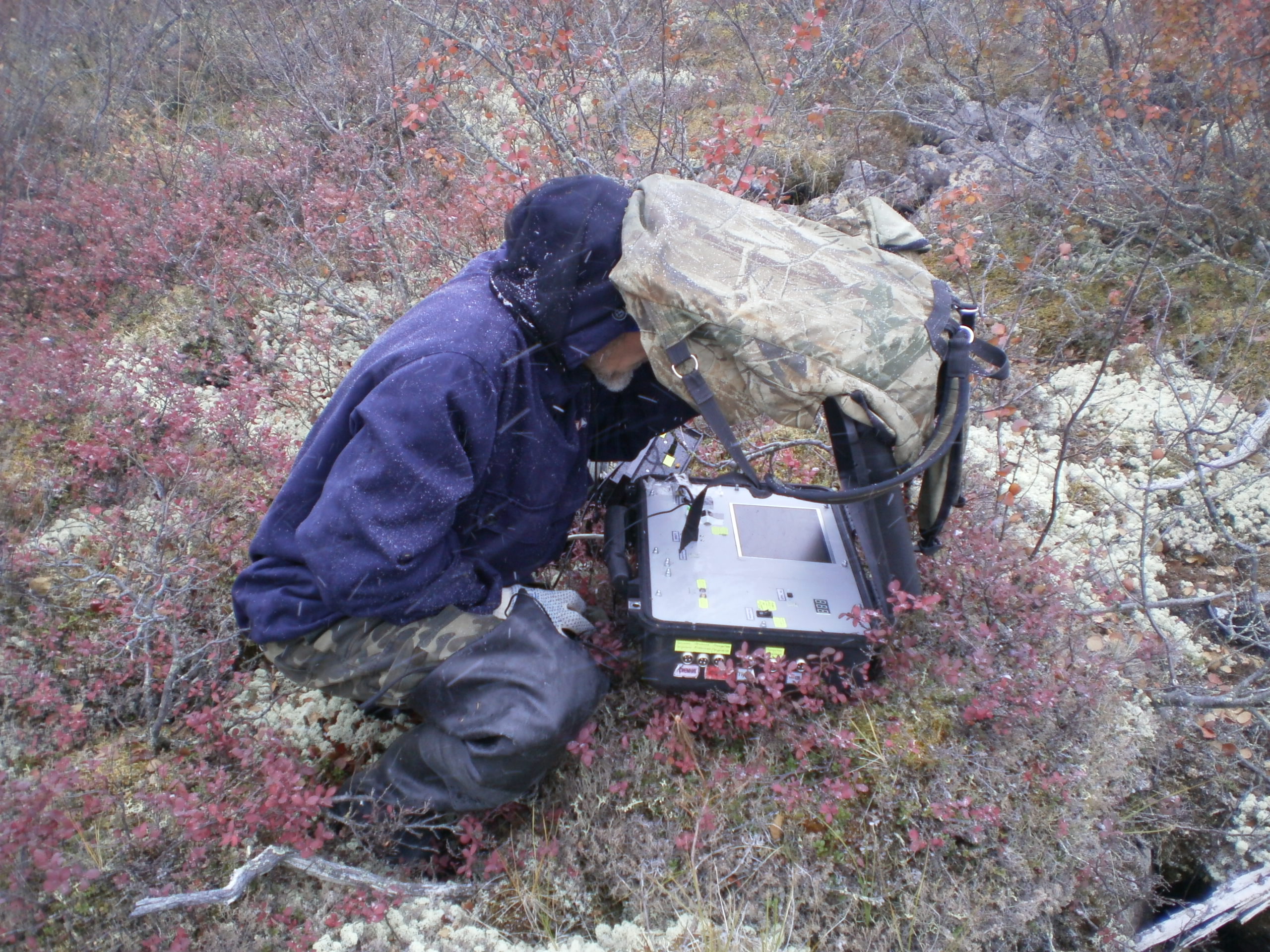
Bakhir DG deploys its exclusive, patent-protected PEMS technology to redefine subsurface exploration. Delivering unprecedented depth and precise deposit boundary definition, this innovation mitigates capital risks across our global exploration and mining operations.
Methodology
Advanced Non-Electric Matter Excitation
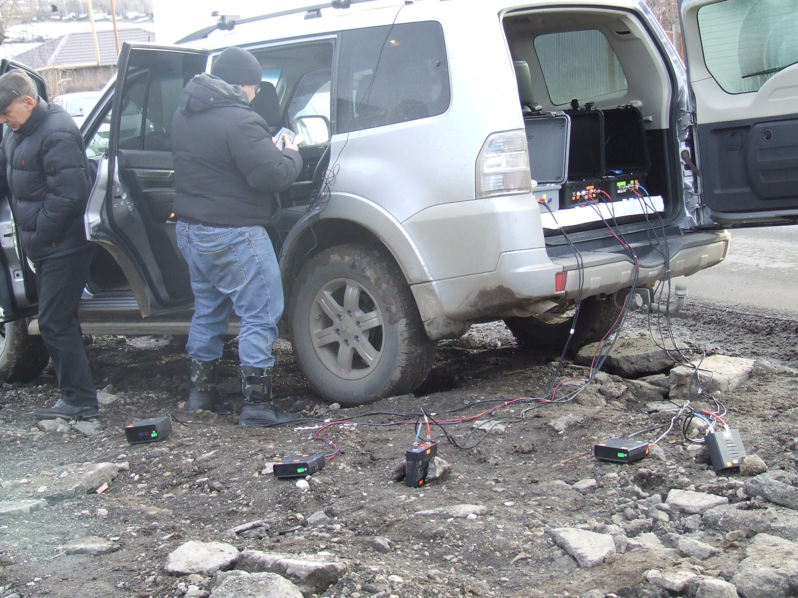
Unlike traditional electromagnetic frameworks where weak secondary fields are obscured by massive primary fields, the PEMS method isolates response signatures during intentional, discrete intervals of inactivity. By exciting the targeted physical matter through specialized pulses, it measures structural interactions with absolute clarity.
This high-accuracy inductive methodology map-shapes coordinates, configuration volumes, and structural contents. This ensures asset validation prior to expensive test drilling.
FAQ
What is PEMS?
PEMS (Pulsed Electromagnetic Sounding) is an advanced geophysical exploration technology used for remote subsurface investigation. The method is based on generating pulsed electromagnetic fields and analyzing the response of geological formations at different depths.
Unlike conventional exploratory drilling, PEMS allows geological assessment without physically penetrating the ground during the exploration stage. This makes the process faster, more cost-effective, and environmentally friendly.
Bakhir DG uses PEMS as the primary exploration method across its mining concessions, including projects in Angola focused on alluvial diamond and gold deposits, manganese, oil, and other mineral resources.
How PEMS Works
A pulsed electromagnetic field is transmitted into the subsurface. Different rocks, minerals, groundwater, and geological structures respond differently depending on their electromagnetic properties.
The received signals are processed using advanced interpretation techniques to create a three-dimensional geological model of the investigated area.
The result is a detailed map of the subsurface that makes it possible to identify promising exploration targets even before drilling and production begin.
Applications of PEMS
Mineral Exploration
- Diamonds and gemstones
- Gold and precious metals
- Platinum group metals (PGMs)
- Rare and rare-earth elements
- Lithium exploration
- Base metals
- Iron ore
- Oil and natural gas
- Coal deposits
- Groundwater and geothermal resources
Geological Studies
- High-resolution geological mapping
- Identification of active fault systems
- Investigation of exogenous geological processes
- Detection of fractured rock zones
- Offshore petroleum prospectivity assessment
Environmental Monitoring
- Detection and monitoring of oil and gas leaks
- Mapping methane accumulation in coal mining areas
- Identification of geothermal resources
Engineering Geophysics
- Detection of weak ground before construction of bridges, dams, buildings, and infrastructure
- Landslide hazard assessment
- Structural integrity monitoring of dams, embankments, and foundations
Why Choose PEMS Instead of Traditional Drilling?
Exploratory drilling to depths of approximately 5 km may cost around USD 7 million per well, while the probability of successfully intersecting the target geological horizon is often no higher than 50%. As a result, many exploration wells produce little or no valuable information 2 out of 3 wells are often dry.
PEMS significantly reduces exploration risk by identifying the most prospective zones before drilling begins.
Key Advantages
- Speed — exploration can be completed in days instead of years.
- Lower Cost — significantly less expensive than exploratory drilling.
- High Accuracy — detailed field measurements combined with advanced geological interpretation.
- Versatility — suitable for mountains, wetlands, shallow water, offshore areas, and other difficult environments.
- Environmental Sustainability — non-invasive technology with virtually no disturbance to the landscape or ecosystem during exploration.
PEMS in the Angola Projects
Within Bakhir DG’s Angola concession, PEMS is used to accurately map alluvial zones containing diamonds and gold, deposits of manganese, oil, gas and rare earth metals identify fault-controlled mineralization, and monitor geological changes during mining operations.
The information obtained through PEMS enables the company to focus exploration and extraction activities on economically viable targets while avoiding unnecessary investment in low-potential areas.
Does PEMS replace exploratory drilling?
No. PEMS is designed to reduce exploration risk by identifying the most prospective targets before drilling.
What minerals can PEMS be used to explore?
PEMS can support exploration for a wide range of natural resources, including:
- Gold
- Diamonds
- Platinum Group Metals (PGMs)
- Rare Earth Elements (REEs)
- Lithium
- Base metals
- Iron ore
- Oil and natural gas
- Coal
- Groundwater and geothermal resources
Can PEMS detect diamonds or gold directly?
Yes.
How deep can PEMS investigate?
The investigation depth depends on geological conditions, survey configuration, and project objectives. Survey parameters are selected individually for each exploration program to achieve the required depth and resolution up to 10 km.
Is PEMS environmentally friendly?
Yes. PEMS is a non-invasive exploration method that does not require excavation or drilling during the initial survey stage. As a result, it has minimal impact on landscapes and ecosystems.
Where can PEMS surveys be performed?
PEMS can be applied in a wide variety of environments, including:
- Mountainous regions
- Forests
- Wetlands
- Deserts
- Offshore and coastal areas
- Remote and difficult-to-access locations
Why is PEMS more cost-effective than traditional exploration?
By identifying high-potential exploration targets before drilling, PEMS helps reduce unnecessary drilling costs, optimize exploration budgets, and improve decision-making during mineral exploration projects.
How does Bakhir DG use PEMS?
Bakhir DG integrates PEMS into its geological exploration workflow to evaluate mining concessions, map favorable geological structures, identify prospective primary and alluvial zones, and support exploration planning. In Angola, the technology is used as part of the company’s exploration program for diamond and gold projects.
How can I request a PEMS survey?
Bakhir DG provides PEMS-based geological exploration services for mining and resource development projects. If you would like to discuss a survey or learn more about our exploration capabilities, please contact our team through the Contact page.